Geographical encyclopedia
Countries of the world
Common information
All the nations of the world in the summary table: name, flag, capital, area, population, continent.
Sovereign states , UN members , States with limited recognitionPlanet Earth , How many countries in the world
Country codes (phone code, barcode)

Russian Federation
Russia is the largest country of the world and consists of 85 regions.
Common information , Cities of Russia
All flags
National flags of all countries of the world.
All national flagsEurope , Asia , Africa , North America
South America , Australia and Oceania
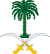
All coats of arms
Coats of arms (emblems) of all countries of the world.
All national coatsEurope , Asia , Africa , North America
South America , Australia and Oceania
Lists
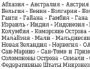
Countries
The names of the countries of the world: the list of states in alphabetical order, links for detailed information.
List of countriesEurope , Asia , Africa , North America
South America , Australia and Oceania
Cities
City lists in alphabetical order, division by first letter.
List of cities , Search for cities by nameThe Encyclopedia of GEO consists of three sections: statistics, lists and national symbols. Statistics contain grouped data about the countries of the world, backed up and sorted according to various indicators. Mainly statistics are being kept on the most popular and sought-after information, such as population and occupied areas. All data is presented as a whole on the planet, and separately for each continent. Another detailed scale is given as follows: the planet - the country - the city. But in any case this is a lot of huge numbers, which can be played with in different ways.
A separate page contains the country codes: telephone, literal, digital, bar codes. A very useful reference table.
Unlike colossal tables with statistics, lists are more concise. However, quite often this is exactly what a site visitor needs. Lists do not contain anything extra and allow you to quickly find the required information. Just as in the previous section, you can access the data on the entire planet, or only on a specific continent, pay attention to the list of states or their capitals. Or perhaps you will be interested in a simple list of cities, or, more precisely, only the megacities.
The state symbols considered mainly as graphic information, are the images of the world flags and coats of arms. There are a lot of other national symbols, such as anthems and mottos, but they are not yet presented on our website.

